
 Trying to add a payment method? You can do this on the

QuickTake:
The Salmonberry Trail project is still a work in progress. But the Banks-Vernonia State Trail and Crown Z Trails go for miles and are well worth exploring.
Last week I suggested hiking a 13-mile railroad grade near Cottage Grove, the setting for Buster Keaton’s classic movie “The General.” This week we’re aiming higher. How about a 43-mile rails-to-trails project from Hillsboro to the Columbia River? Or a proposed 82-mile bike path from Hillsboro to the beach at Tillamook?
Some of the earliest logging railroads in Oregon snaked through the northern Coast Range, hauling timber to mills near Portland. Some of those historic routes are now trails within parks. To sample them, head to L.L. “Stub” Stewart State Park, where you can stay in a log cabin by night and explore trails by day.

Loran LaSells “Stub” Stewart grew up in the Rujada lumber camp east of Cottage Grove. He inherited a chunk of the Bohemia Lumber Company and built an innovative timber empire in Lane County.
After he spent a while in state politics, a new state park in the Coast Range near Hillsboro was named for Stewart in 2007. The park consists of third-growth Douglas fir forest, but the trees are getting bigger and the facilities are first rate, with 78 car campsites, 12 walk-in tent sites, 15 equestrian campsites, and 15 rental cabins.
Once you’ve set up camp, hike a short sample of the wide, paved Banks-Vernonia State Trail, which traces an abandoned railroad grade through park.

This railroad was built between 1919 and 1922 to haul lumber from the Oregon-American mill in Vernonia. After the mill closed in 1957, a steam excursion train ran here for five years. The rails were removed in 1973 and the state parks department bought the line in 1974.
All 20 miles of the trail between Banks (near Hillsboro) and Vernonia are paved, with a parallel bark dust path for horses.
A picnic area beside the huge, intact Buxton trestle is a good place to start your visit. Find it by driving Highway 26 west of Portland 28 miles. Near milepost 46, turn north off Highway 26 onto Fisher Road for 0.8 mile. Then curve right on Bacona Road for 0.6 mile to the trailhead parking area on the right.
Walk to a brown metal gate at the far end of the parking lot and turn sharply right down a wide gravel path marked “walk bicycles.” This path descends to a bridge over Mendenhall Creek and then climbs to the paved railroad route. Turn right across the trestle, a bridge that has been planked and railed for safety. On the far side, a paved path to the right leads back to your car for a short loop.
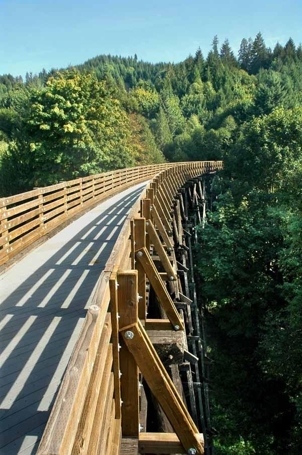
If you’re going strong, or if you’re on a bicycle, you could continue on the trail through Stub Stewart State Park all the way to the old mill town of Vernonia. At that point you’d connect with another rails-to-trails project, the Crown Z Trail, that extends another 23 miles to the Columbia River.
If you’re up to bicycling 23 miles, go for it. Otherwise, I’d suggest you drive to the far end of the Crown Z Trail at Scappoose and hike a section there, where railroad cars once dumped logs into the Multnomah Channel of the Columbia River.
Scappoose is on Highway 30, about 20 miles north of Portland. The Crown Z Trail crosses the highway in the middle of town, at the traffic light for South Vernonia Road. To see the end of the trail at Chapman Landing, however, turn off the highway two traffic lights to the south, onto East Columbia Avenue. This intersection is just south of milepost 21. Follow Columbia Avenue east 1.7 miles to the Chapman Landing Trailhead on the right.
Walk the wide, level trail 0.3 miles through cottonwoods to the landing, now a picnic area. The river view here is lovely, but you’ll probably find yourself saying, “That wasn’t a very long hike.”
So get back in your car, drive back to Highway 30, turn right to the second light, and turn left on Vernonia Road for 7 miles to the Ruley Trailhead on the left. The parking area has a picnic shelter, a restroom, an antique bulldozer and interpretive plaques about local history.
Set out on the gravel trail to the west, slightly uphill. For the first 1.6 miles you’ll parallel the paved road, passing fields, driveways and farm houses. But then you enter Douglas fir woods and leave the sounds of civilization behind. At Nehalem Divide the railroad grade crests the summit by ducking under a highway bridge. A fork to the left climbs to a parking area by the bridge, a good turnaround point.

Did I suggest that you might also follow a railroad grade all the way to the ocean at Tillamook? If so, I’m getting ahead of things.
The 82-mile Salmonberry River railroad grade from Hillsboro to the Coast isn’t yet open to the public. That spectacular route, through a roadless river valley, includes more than a dozen tunnels and trestles. A flood in 2007 left washouts with rails hanging in the air. The locomotives and railcars stranded in Tillamook have since been used for tourist excursions between Garibaldi and Wheeler.
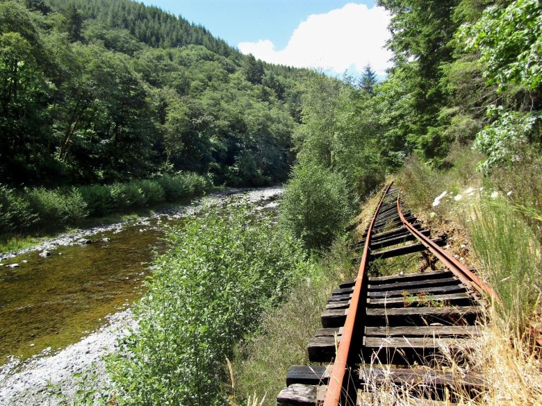
Meanwhile, a nonprofit group has been collecting donations to rebuild the Salmonberry rail line as a hiker-biker trail. Unsafe tunnels and trestles need repair. Private land will have to be bought. More than a $100 million might be required to make the dream a reality. But a large part of the money has already been raised, and hopes are high, as the project’s website explains.
Stub Stewart, the timber baron of Lane County, would smile at the prospect. He served for years on state parks boards. Imagine, a public trail leading from the park with his name to the ocean!

