
 Trying to add a payment method? You can do this on the


QuickTake:
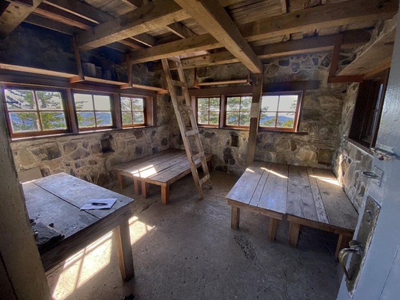
The stone Pechuck Lookout is accessed via a trail through the Table Rock Wilderness and is open to stay in, first-come, first served.
Only about 80 of Oregon’s original 849 fire lookout buildings have survived. Two dozen of these are available for rent — but the idea of spending a night on a lofty mountaintop has become so popular that it’s hard to book a spot.
What if I told you there’s a nicely restored 1932 stone lookout cabin available for free? It’s true! A lovely 2.8-mile trail climbs through the Table Rock Wilderness to the Pechuck Lookout, open to guests on a first-come, first-served basis.
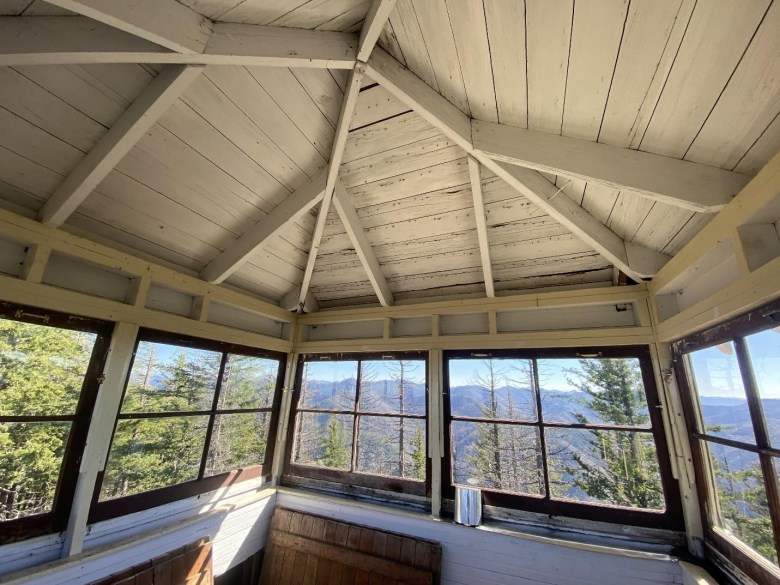
The unlocked stone cabin has windows all around, plywood bunks, an outdoor firepit, a composting toilet nearby, and an indoor ladder to an upstairs cupola. The view is good, but a side trail leads to an even better view atop Chicken Rock, where the panorama extends from Mount Rainier to the Three Sisters and even Marys Peak.
There’s always a hitch, of course. In this case it’s the drive. The trailhead is an hour’s drive from Molalla, which is not exactly the center of the world, halfway between Woodburn and Estacada.
From Eugene, the drive takes almost three hours. Along the way you follow the Molalla River through a scenic canyon. When pavement ends, the final 7 miles are on one-lane gravel.
This neck of the woods is a checkerboard of land ownership. The feds built a lookout in 1918 on government land, a mile east of the current lookout site. In 1932 a private timber company built the Pechuck Lookout to keep an eye on their own property.
Pechuck is one of only two stone lookouts left in Oregon. The other, atop the Watchman on the rim of Crater Lake, was also built in 1932. By then the “cupola” style of lookout was already going out of fashion.
The cupola is a small second story with a better view than the ground-level cabin. The idea was that the lookout staffer would live downstairs, but climb up the ladder every few minutes to spot smokes. Later lookouts were simply one-story cabins built atop tall towers.
Pechuck was staffed regularly until 1964. In 1985 Willamette Industries agreed to a land swap to consolidate their ownings. The Bureau of Land Management acquired the lookout, and restored it from 1989 to 1995. New this past year is the toilet, an outdoor box with a seat but no walls.
The terrifying 2020 wildfires that burned the cities of Blue River and Detroit mostly swept around the edges of the Table Rock Wilderness, narrowly missing the lookout but leaving a few dead trees. On the drive to the trailhead you’ll pass a few miles of moonscape where burned forest was clear-cut.
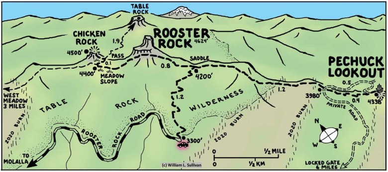
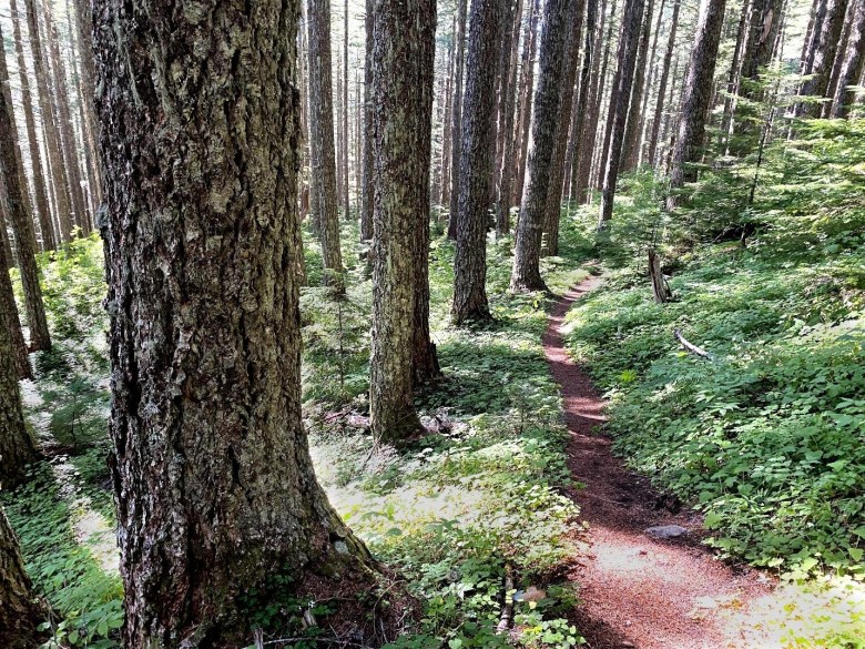
From the small parking turnaround at the end of gravel Rooster Rock Road, the path switchbacks up through a Douglas fir forest where rhododendrons bloom pink in June.
Expect to puff a bit, because the path gains 900 feet of elevation in the first 1.2 miles.
Then you reach a junction atop the ridge, and you face a decision. To the left a mostly level trail leads 0.9 mile to the area’s best viewpoint atop Chicken Rock. To the right the ridgetop trail ambles up and down 1.6 miles to the lookout.
When Janell and I visited, we turned left, heading for the easier destination first. After 0.7 mile through the woods the trail suddenly breaks out into a meadow slope full of wildflowers. At the far end of the meadow, ignore the trail that goes straight into the woods and instead switchback up to the right. This path climbs to a pass at the top of the meadow.
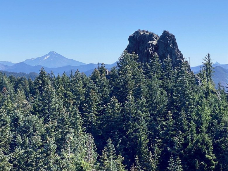
Here there’s another junction. The path straight ahead dives down into the woods, leading eventually to Table Rock. Don’t go that way. Instead turn left, on a trail that climbs a ridge 400 feet to a rocky outcrop with the view. This knoll is known as Chicken Rock because it has a front-row view of Rooster Rock, an even bigger rock pinnacle.
Stop for lunch here to enjoy the view. Mount Jefferson is the big white pyramid on the horizon to the left of Rooster Rock. To the right are Three Fingered Jack, Mount Washington and the Three Sisters. To the north, Mount Hood is hiding behind a ridge, but on a clear day you can spot flat-topped Mount St. Helens and a distant white cloud that is actually Mount Rainier.
Hiking back from Chicken Rock, Janell’s knee was feeling wobbly, so she headed back down to the car. I continued straight along the ridge toward Pechuck Lookout.
This part of the hike crosses a few burned areas where you might have to step over a blackened log or two. About half a mile before the lookout you’ll reach an old road. This is a private, gated timber company road that BLM staffers use to drive closer to the lookout for maintenance. Cross the road to continue on the trail for 0.4 mile up to the lookout.
If you’re spending the night, bring a sleeping bag, a pad, a backpacking cookstove and a light. There is supposed to be a spring a quarter mile down the lookout road, on the downhill side, but I’d suggest bringing water.
A sign asks that you use the provided broom to sweep out the cabin, and that you keep the door shut to discourage woodrats. The place does have a faint ratty smell. But then, dealing with critters is often part of life at a fire lookout. And when you’re visiting for free, who’s to complain?
If you go
Drive Interstate 5 to Woodburn exit 271 and drive east through town, keeping straight at junctions, for 15 miles to Molalla.
At the stoplight in downtown Molalla, continue straight on Highway 211 toward Estacada for 0.6 miles. Then turn right onto South Mathias Road for 0.3 miles, curve left onto unmarked South Feyrer Park Road for 1.6 miles to a T-shaped junction, and turn right onto South Dickey Prairie Road.
Follow this road past several jogs for a total of 5.2 miles to a poorly marked junction where you need to turn right across a two-lane bridge. Signs are often missing, so watch your odometer carefully. After crossing the bridge curve left to stay on paved South Molalla Forest Road 6-3E-6.
Continue 12.8 miles to a fork. Ignore the gravel fork up to the left labeled “Table Rock Trailhead,” and instead keep right on the main paved road, which promptly crosses a bridge and turns to gravel. After half a mile on this wide gravel road, fork uphill to the left onto one-lane Rooster Rock Road.
Follow this road 6.5 miles to the trailhead turnaround at its end.

